Dehergad
Jai Shreeram
Nashik district is blessed with some of the highest and most beautiful mountain ranges in the Sahyadri's. Our foresighted rulers made the best use of this terrain and constructed some 58 forts across Nashik & Dhule district.
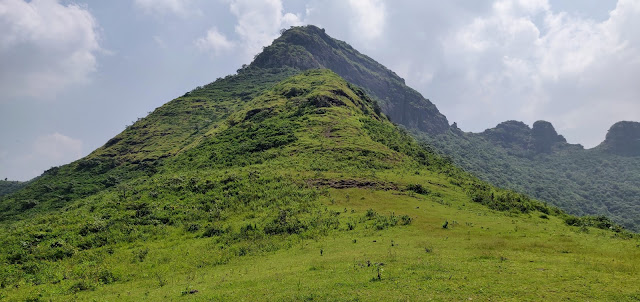
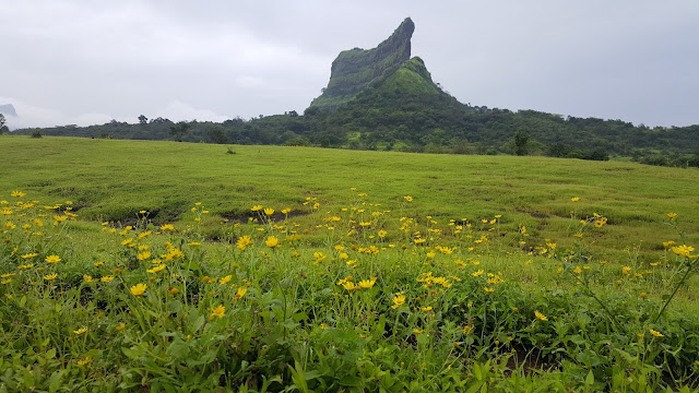
Dehergad is one such imposing fort.While it is lesser known as compared to its more popular neighbour Ramshej, Deher offers a very fullfilling hike to a trekker keen to take the off beat path.It is situated in Dindori Taluka of Nashik district. The fort lies just ahead of Ramshej fort and is built on an imposing twin peak mountain which is visible when one travels from Nashik towards Gujarat on Dharampur road.
Myself, Onkar oak and Vijay Gurjar had originally started from Pune with the intention of doing a 2 day trek covering Bitangad, Balwantgad and Kavnai. However there was a mini landslide just about 5 kms before Bitanwadi, which prevented us from driving further.
We quickly changed plans and decided to trek to Balwantgad and Kawnai instead on Day 1.We covered both forts comfortably on day one and stayed overnight at Nashik at Nana's house at Nashik road (Sanjay Amrutkar (Nana to us) is a well known and respected figure in trekking, photography, writing......and the list goes on). He is one of the most versatile and positive person i have met in my life. Nana and his family magnimously welcomed us at their house. We had a very delicious dinner with them and after our meal we spent some quality time chatting late in the night together.
Onkar meantime had touchbased with two more veteran trekkers and his friends at Nashik, Sudarshan and Rahul.(Both are well known and respected names in trekking circles in Nashik).They had very graciously taken time out and had agreed to join us for a day hike on Day 2.Our original plan was to go to Ramshej but both of them insisted that Dehergad is a lesser explored fort and we should go there.
On Sunday, Rahul and Sudarshan promptly picked us up in Rahul's massive Isuzu pick up. We stopped enroute for a sumptouous break fast of Misal Pav and Tea.Post break fast we passed the beautiful Ramshej fort on our right and reached the base village of Dehergad.
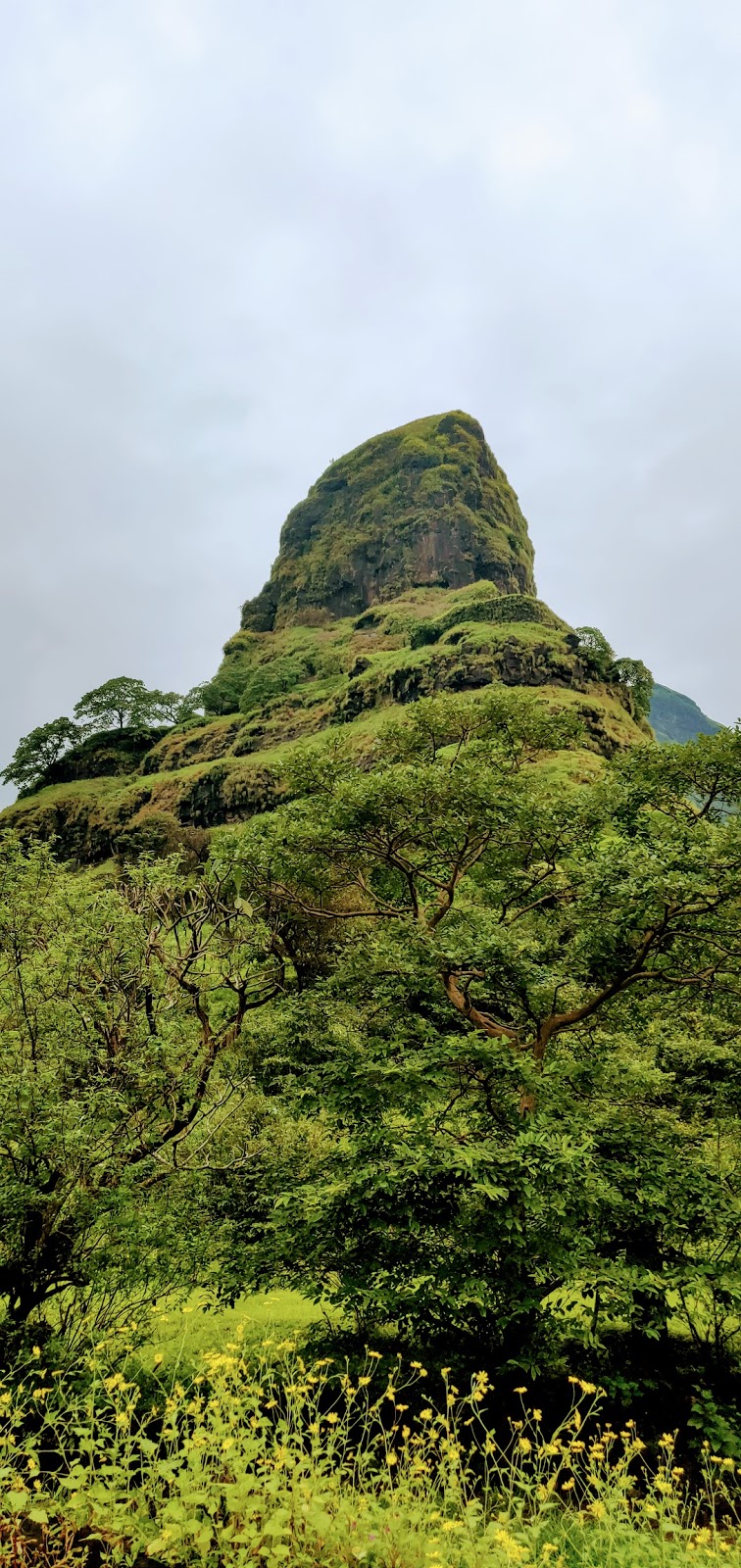
Dehergad looked imposing from the base. The fort is at a height of 1091 meters or 3578 feet above mean sea level.The climb from the base takes about 1 hour and grade is easy to medium.
We parked our car near a village house in Deherwadi and started our hike just from behind the house. We were probably amongst the few trekkers who had ventured to climb Dehergad in 2020 as the entire year had been spent in lock downs.
The climb to Dehergad fort is in 3 stages:
Stage1. From the base to the lower plateau.
Stage 2: Lower plateau upto the upper middle portion of the fort
and finally the climb at the top towards the Ballekilla.
The climb is quite direct and except for the initial traverse, one reaches the summit of the fort in a relatively short time of 1 hour despite the significant elevation of the fort.
As this was my first trek after recovering from Corona, the earlier days hikes had given me some much needed reaffirmation, that my stamina was slowly coming back.
This steep and rapid climb was going to go a long way in reaffirming my self belief in my recovery.
We first followed a trail which took us to a lower plateau. From here the trail climbs from the right side of the fort, after about 15 minutes the trail takes a small U turn towards the left and comes towards the left of the fort. Now the climb becomes steeper and through dense vegetation. We were fortunate to capture some beautiful snaps of the elusive Karvi flowers.
We pressed on keeping the fort to our right. We had gained quite a bit of height by now. The air was surprisingly humid and still during the initial climb, but as we gained height the mountain sent some fresh cool breeze to welcome us to its summit.
After a steady climb of about 45 minutes we reached a small rock patch which we negotiated comfortably.
All along we were being greeted by beautiful flora, which made the climb quite pleasant. The myraid colours soothed our eyes and soul despite the October Sun breathing fire.
After the rock patch we could see carved steps which led us to the Maha darwaja of the fort. The door frame has however collapsed.There is a Linga placed right at the front and we can see some water cisterns which must have been built for the troops guarding the entrance to the fort. On the other side of the cisterns on our left a few steps led us to the ballekilla or the main citadel of the fort.
The Ballekilla was covered by tall grass. From here we circled the fort in a clockwise direction keeping the Ballekilla to our right and soon came across 2 large water cisterns. The water was crystal clear and potable. One can also see a beautiful Shivling carved from stone placed on a pedestal.There are 4/5 more water tanks to the left of these cisterns, but the water in them is not potable.
From this eastern end of the fort we could see Ramshej fort and also Bhorgad Fort to our south. The access for civilians to Bhorgad Fort is restricted due to air force base and radar stations which have been erected on the fort. We could also see the road deep below built by the Indian Airforce going towards Bhorgad top.
The
Dehergad fort was primarily used as a watch tower to keep watch on the ancient
trade route of Peth-Savalgoan-Dindori and provide support to Bhorgad
fort and the near by fort of Ramshej.
This portion of the fort reminded me of Sumargad fort. The fort is quite similar to Sumargad in terms of the following characteristics, both are imposing in height, are relatively lesser known, stand tall amongst the surrounding terrain, have large water cisterns, tall grass on fort top due to which the fort remains and relics are hidden from view, both are connected to another fort by a ridge and there is Shiva temple on both forts.
We descended the fort in about 45 minutes and reached Nashik by 3 pm. It was a very satisfying and unique hike as the fort was a complete unknown entity for us and proved to be a very capable and versatile fort adorned with beautiful flora all along the trail.
Trek Team: Rahul Sonawane, Sudarshan Kulthe,Onkar Oak,Vijay Gurjar, Saurabh Ranade and Amit Marathe.
Pic credit: Amit Marathe
Some important points to be noted:
1). Please ensure that you exercise regularly before you take up this or any
other arduous trek.
2). Please do not litter and and carry all
your waste back with you after the trek.
3). Stay close with the group and do not
wander alone in the forest.
4). At all times carry at least 3 litres of
water per day. Very important to stay hydrated.
5). Respect the guides you hire and make them
a part of your trekking team, share your food with them and do not give your
sacks to them to carry.
6). Try and gather information about the
geography and historical importance of the places you visit.
7). Please respect the time given to your
fellow trek mates and always be on time
P. S : Also contribute to the villagers in whichever form, cash or kind so that you become a part of their ecosystem. A simple act of giving basic medicine/first aid kits to the village police patil or Sarpanch can go a long way in establishing a bond with these simple and kind hearted folks of our mother land.
Take care and God bless.


Comments
Post a Comment