Posts

Bherand Naal and Shevtya Ghat

Image
                                                                            Jai Shri Ram "As we started ascending Bherand Naal, the hostile terrain started having its effect on us. Our mind started playing games with us as the climb became steeper, the boulders bigger and the scorching heat of the western Sun beating down harder. Our throats were parched and the climb seemed never ending. The gorge tried to stop our ascent with its full might serving a concoction of challenges like thorny bushes, challenging boulder laden routes, a rock patch at the fag end, extreme ascent at an angle of 70%-75% with scree and loose soil and exit almost blocked" The above challenges are typical features of ascending a less frequented and difficult level gorge cum ghat route. The Bherand Naal ascent was proving to be ...
Dehergad

Image
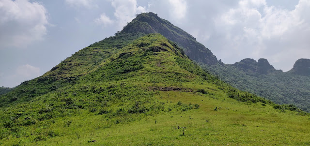
Jai Shreeram  Nashik district is blessed with some of the highest and most beautiful mountain ranges in the Sahyadri's. Our foresighted rulers made the best use of this terrain and constructed some 58 forts across Nashik & Dhule district.  Dehergad is one such imposing fort.While it is lesser known as compared to its more popular neighbour Ramshej, Deher offers a very fullfilling hike to a trekker keen to take the off beat path.It is situated in Dindori Taluka of Nashik district. The fort lies just ahead of Ramshej fort and is built on an imposing twin peak mountain which is visible when one travels from Nashik towards Gujarat on Dharampur road. Myself, Onkar oak and Vijay Gurjar had originally started from Pune with the intention of doing a 2 day trek covering Bitangad, Balwantgad and Kavnai. However there was a mini landslide just about 5 kms before Bitanwadi, which prevented us from driving further. We quickly changed plans and decided to trek to Balwantgad and Kawnai i...

Mystical Kandat ! Nalli-chi Vaat - Parvat - Chakdev - Mahimandangad Fort - Ambivali Ghat ( Mahableshwar- Jawli-Koyna region)

Image
Jai Shri Ram                                                                                                 Kandat.......!! The Sanskrit meaning of this word is Deep Forest. (Kan is Kannan or forest and Dat is deep). The Kandat valley is formed by the Kandati river which is a tributary to the Koyna. The area lies to the South of Mahabaleshwar about 50 km from Tapola on the border of Satara and Ratnagiri districts. Due to the backwaters of Koyna, this entire land had been cut off from the rest of the world until Raghuveer Ghat road was built from Khed via Khopi reaching the higher land of the Sahyadri mountains near Shindi village. Thus when we started formulating our plans to trek in this mystical lan...